<?xml version="1.0" encoding="UTF-8"?>
<feed xmlns="http://www.w3.org/2005/Atom">
  <title type="text">Cleveland Historical</title>
  <updated>2026-08-22T05:54:43+00:00</updated>
  <generator uri="http://framework.zend.com" version="1.12.20">Zend_Feed_Writer</generator>
  <link rel="alternate" type="text/html" href="https://temp.clevelandhistorical.clevelandhistorical.reclaim.hosting/"/>
  <link rel="self" type="application/atom+xml" href="https://temp.clevelandhistorical.clevelandhistorical.reclaim.hosting/items/browse?output=rss2"/>
  <id>https://temp.clevelandhistorical.clevelandhistorical.reclaim.hosting/</id>
  <author>
    <name>Cleveland Historical</name>
    <uri>https://temp.clevelandhistorical.clevelandhistorical.reclaim.hosting</uri>
  </author>
  <link rel="hub" href="http://pubsubhubbub.appspot.com/"/>
  <entry>
    <title type="html"><![CDATA[Shaker Historical Society and Museum: Challenging Suburban Resistance and Shaping Community Identity in the Quest for Home]]></title>
    <summary type="html"><![CDATA[<img src="https://temp.clevelandhistorical.clevelandhistorical.reclaim.hosting/files/fullsize/50726ca80912a440e06313046e9fd8e7.jpg" alt="Shaker Historical Society, 16740 South Park Boulevard (Scrapbook Excerpt)" /><br/><p>The Shaker Historical Society and Museum has a rich history marked by its successful establishment and resilience in overcoming challenges to secure a permanent location. The Museum presents historical artifacts and educational programs that extend beyond the <a href="https://clevelandhistorical.org/items/show/674">North Union Shaker</a> community, engaging Shaker Heights residents in public history. The legacy of the Van Sweringen brothers, who influenced the design of city streets and community values, is deeply embedded in the area’s physical layout and reflected in the Museum's role within the community.</p><p>Building on this foundation of historical interest, the story of the North Union Shaker community itself is central to understanding the origins of Shaker Heights. Founded by Ralph Russell in 1822, the Shaker community occupied the lands now known as Shaker Heights and Cleveland Heights. Although the community disbanded in 1889, its utopian ideals left a lasting legacy that helped shape the vision of the master-planned suburb. Interest in the Shakers within the community began to grow in the mid-1920s, when the Shaker Heights School District started incorporating local history into its educational programs. Teachers Edythe Turner and Pearl Lee Stark played a pivotal role in this effort, collecting Shaker artifacts and embedding them into the third-grade curriculum, ensuring that future generations would engage with this important chapter of the area’s past.</p><p>The Shaker community attracted interest from several institutions in the Cleveland area, with Wallace H. Cathcart, former director of the Western Reserve Historical Society (WRHS), initiating the Shaker collection in 1911. Today, the WRHS holds approximately 900 Shaker photographs from 1860 to 1920, which were vital in shaping a coherent public understanding of the North Union Shaker community’s legacy. Caroline B. Piercy, a Shaker Heights resident, extensively studied the Cathcart collection and published <em>The Valley of God’s Pleasure: A Saga of the North Union Shaker Community</em> in 1951. Her research led to connections with other local residents, including Rev. John M. Schott, Cary Alburn, Benjamin Jenks, and Councilman John A. Hecker, who took a major step in preserving this history by founding the Shaker Historical Society and Museum (SHS). Elizabeth B. Nord, the Museum's volunteer curator for twenty years until her death in 1972, was also instrumental in this effort. The Society began gathering Shaker artifacts and donations, hosting its first garden party on June 11, 1948, in the Shaker Room of the WRHS.</p><p>Over the next twenty-two years, the Shaker Historical Society relocated seven times before settling into a storefront at 3488 Lee Road in 1968. However, this location proved unsustainable due to high costs, prompting the board to seek a more permanent home for the Society and Museum. In 1966, a special board meeting was held in the basement of Boulevard School to discuss the donation of the Myers mansion. Designed by architect Daniel Reamer in 1910 for Louis Myers of the Van Sweringen Company, the mansion was being negotiated by his son, Frank Myers, as a potential permanent home for the SHS. The Myers mansion was historically significant, situated on the original site of the Shaker settlers’ farm and near Horseshoe Lake, created by the settlers’ dam. Despite this, local residents and neighbors at the time strongly opposed the Museum’s move into the area. Their concerns about relocating the Museum to a residential neighborhood reflected the nineteenth-century ideals behind the Van Sweringen brothers’ vision of an ideal “utopia.” In response, Mayor Paul K. Jones decided to allow neighborhood residents to voice their opinions based on issues of zoning policies.</p><p>The Van Sweringen brothers sought to control property values in Shaker Heights through deed restrictions, a common practice in American suburban development. By promoting homeownership, they aimed to stabilize property values and prevent “undesirable” neighbors, enforcing both aesthetic standards and racial covenants. In 1925, they introduced Restriction No. 5, which encouraged residents to return old property deeds for approval before selling. Zoning regulations were also implemented, designating certain areas for single-family homes while allowing commercial use in other zones. The northern areas of South Park Boulevard and Lee Road were reserved for single-family residences, while the neighborhoods south of South Woodland Road and Van Aken Boulevard were subject to a mix of zoning types. Together, Restriction No. 5 and the expanded zoning regulations reinforced the Van Sweringen brothers' vision of a white, upper-to-middle-class "utopia."</p><p>Although Shaker was well on its way to becoming a community that embraced social diversity, the Van Sweringen vision of exclusivity and zoning control was echoed decades later when the Shaker Historical Society's proposal to relocate to the South Park Boulevard neighborhood faced resistance. Much like the earlier concerns over "social invasion" and zoning laws, opponents feared the impact of the Society's move on the residential character of the area. <span>To bypass these objections, trustee Frank Myers donated the property to the state with vice president William R. Van Aken handling the legal complexities of the transfer, enabling the Society to contract with the State Department of Public Works and avoid city zoning regulations.</span></p><p>This effort to overcome zoning resistance marked a pivotal moment in the Shaker Historical Society's development and expansion. Drawing on this achievement, the Society began to shift its focus toward broader public engagement. The president of the SHS at the time, William Van Aken, discussed opening the Museum to all residents of northeastern Ohio, and the public was first invited into the space during a tour conducted around the Shaker Lakes in 1970. Building on this momentum, the Women's Committee of the SHS was established in June 1971 to increase interest, funding, and volunteer support for the museum. In 1972, Elizabeth Nord made a significant contribution by donating her personal library to the SHS and receiving the Golden Deeds Award from the Exchange Club of the Heights. Tragically, she passed away from a heart attack just four months later. The 1980s marked a period of expansion for the Society, which showcased four major exhibits and elected its first female president in 1988, further solidifying its commitment to inclusive public history.</p><p>The success of these early efforts laid the groundwork for the Shaker Historical Society’s continued growth and evolution. As the Society expanded its reach and strengthened its community ties, it also began to reflect the values and identity of Shaker Heights itself. The suburb, deeply intertwined with the concept of "home," influenced the Society’s transition into a single-family residence, further aligning its mission with the broader emphasis on home and place that defines the area. By broadening its focus from solely representing the Shakers to engaging more deeply with the diverse local community, the Shaker Historical Society and Museum is forging a new identity for public history in Shaker Heights—one that reflects the suburb's contemporary values while enriching its historical narrative.</p><p>Today, the Shaker Historical Society and Museum, along with the Elizabeth B. Nord Memorial Library and Archives, operates in its permanent location at 16740 South Park Boulevard. Despite past resistance, the museum now stands as a hub for public history, education, and community development, honoring the legacy of the North Union Shakers on the very land they once inhabited.</p><p><em><strong><a href="https://temp.clevelandhistorical.clevelandhistorical.reclaim.hosting/items/show/1040">For more (including 14 images) view the original article</a></strong></em></p>]]></summary>
    <published>2024-11-26T01:14:49+00:00</published>
    <updated>2026-04-17T19:17:43+00:00</updated>
    <link rel="alternate" type="text/html" href="https://temp.clevelandhistorical.clevelandhistorical.reclaim.hosting/items/show/1040"/>
    <id>https://temp.clevelandhistorical.clevelandhistorical.reclaim.hosting/items/show/1040</id>
    <author>
      <name>Makialani Kanewa-Mariano</name>
    </author>
  </entry>
  <entry>
    <title type="html"><![CDATA[Myron T. Herrick: Cleveland&#039;s Forgotten Railroad Baron]]></title>
    <summary type="html"><![CDATA[<img src="https://temp.clevelandhistorical.clevelandhistorical.reclaim.hosting/files/fullsize/40e9266474998ec838e2a617364e7746.jpg" alt="Myron T. Herrick" /><br/><p>Myron Timothy Herrick (1854-1929) is most often remembered as being raised as a farmer's son in Wellington, Ohio, a lawyer who became president of the Society for Savings bank in Cleveland, a Republican who was elected the 42nd Governor of the State of Ohio (1903-1905), and two-time appointee as ambassador to France (1912-1914, 1920-1929). What is not commonly known is how he used his legal and financial influence, along with other investors, to control and expand various railroads of Ohio and the nation.</p><p>Herrick was associated with several American financiers that invested in railroads and as a group were called the "Fuller Syndicate," organized by investor Edward Layton Fuller, president of the International Salt Company. Such syndicates were numerous in the United States and were composed of wealthy and influential individuals who combined financial resources for a common purpose during the late nineteenth and early twentieth centuries.</p><p>Railroad land acquisition, construction, and operation was usually very expensive and many railroad companies had losses that exceeded income for a variety of reasons and eventually fell into receivership. One such railroad was the Wheeling & Lake Erie Railroad (W&LE), of which Herrick was appointed receiver  in January 1897.  With a route of 278 miles extending between Toledo and Martins Ferry, Ohio, it was the first railroad that Herrick acquired for the group.</p><p>At that time Herrick knew almost nothing about the operation of a railroad. He found the W&LE property in extremely bad shape. It was encumbered with debt and had little or no financial standing. Herrick decided that it would require at least $1.5 million to put the road in even a fair condition. He applied to eastern financiers to obtain the funds required for the project, but such a high interest rate was demanded that Herrick decided to go elsewhere for the loan. Eventually the bonds were practically all placed in the west, and the improvements to the W&LE were soon under way. In eighteen months, Herrick credited himself with doubling the earnings of the railroad and reducing expenses by fifty percent even while initiating much-needed improvements totaling one million dollars,  which consisted of building new bridges, reducing grades, and improving the roadbed.</p><p>As a result of the W&LE reorganization, Herrick was also able to control and consolidate the assets of the Cleveland, Canton & Southern Railroad. From its downtown passenger depot in Cleveland, which was  located at the corner of Huron Road and Ontario Street, this acquisition added another 209.59 miles of track extending south to Zanesville, Ohio, with an eastern branch to Chagrin Falls. Once  again improvements were required and were soon underway, and as a result the combined properties achieved physical and financial stability. Myron Herrick's actions did not go unnoticed and soon other robber barons hoped to add the W&LE to their empires. The Vanderbilts, the Pennsylvania Railroad, and the Gould interests were all anxious to secure control. The Goulds finally won out, and the W&LE was destined to fulfill a dream as being part of the first coast to coast transcontinental system.</p><p>George Jay Gould, son of ruthless rail baron Jay Gould, controlled the Western Pacific, Denver & Rio Grande Western, and the Wabash Railroad. Herrick's Wheeling & Lake Erie Railroad served Gould's desire to reach ever closer to the east coast, and also served steel magnate Andrew Carnegie's desire for another route to ship his steel west. Herrick acquired several smaller rail lines which linked the W&LE to Pittsburgh and created the Wabash Pittsburgh Terminal Railway. In 1902, Herrick was instrumental in obtaining the Western Maryland Railroad, whose assets were controlled by the City of Baltimore, giving Gould his east coast terminal. The Western Maryland needed to be extended from Hagerstown through rugged country to Connellsville, Pennsylvania, to link the western lines to the east coast. In retaliation for Herrick's acquisition for Gould, the rival Pennsylvania Railroad demanded that Western Union Telegraph, in which Gould owned substantial stock, remove all of its telegraph lines and poles from the Pennsylvania Railroad rights of way, and also remove all telegraph operators and stations along the system.</p><p>In 1906, Herrick proposed construction of a new union station in Cleveland.  The station was to be located on land adjacent to Public Square and served by the Wheeling & Lake Erie Railroad, the Baltimore & Ohio Railroad, and the Erie Railroad. During that same year, the Western Maryland Railroad connection to Connellsville had only reached as far as Cumberland, Maryland, and the remaining line was postponed due to insufficient funds.  Unfortunately, these projects never materialized because of the financial uncertainties following the Panic of 1907. Visions of a coast-to-coast railroad were dashed when both the Western Maryland and Wabash Pittsburgh Terminal railroads fell into receivership in 1907, followed by the Wheeling & Lake Erie in 1908. Herrick returned as president of Society for Savings on May 1, 1908, and at the same time severed most of his connections with the railroad business. His last service to Cleveland railroads occurred in 1911, when on behalf of his son, Herrick went to New York to negotiate financing for the new Cleveland Union Terminal project envisioned by the Van Sweringen brothers. With its completion in 1930, the Cleveland Union Terminal finally gave the city its new train station that Myron T. Herrick had proposed 24 years earlier.</p><p><em><strong><a href="https://temp.clevelandhistorical.clevelandhistorical.reclaim.hosting/items/show/679">For more (including 8 images) view the original article</a></strong></em></p>]]></summary>
    <published>2014-12-04T22:07:21+00:00</published>
    <updated>2026-04-17T19:17:40+00:00</updated>
    <link rel="alternate" type="text/html" href="https://temp.clevelandhistorical.clevelandhistorical.reclaim.hosting/items/show/679"/>
    <id>https://temp.clevelandhistorical.clevelandhistorical.reclaim.hosting/items/show/679</id>
    <author>
      <name>David Kachinko</name>
    </author>
  </entry>
  <entry>
    <title type="html"><![CDATA[Cleveland and Youngstown Railroad: Constructing a Long, Gradual Grade Down from the Heights]]></title>
    <summary type="html"><![CDATA[<img src="https://temp.clevelandhistorical.clevelandhistorical.reclaim.hosting/files/fullsize/510a3a0e4dfc6148d9a7590675879be2.jpg" alt="Cutting the Trench, 1915" /><br/><p>The settlement of the Heights on Cleveland's east side was dependent upon electric streetcars with sufficient power to ascend the Portage Escarpment at Cedar Glen in the 1890s. From there, streetcars opened heights land for development progressively farther east until the Van Sweringen brothers faced the task of making their distant Shaker Heights project accessible to downtown. The Vans created the Cleveland & Youngstown Railroad to make this connection, envisioning an interurban train linking Cleveland to the growing east side, and specifically their Shaker Village development (later Shaker Heights). The C&Y became their means of performing a number of transportation projects, building freight yards for other railroads and, here, putting in place the infrastructure necessary to bring the Shaker Rapid down off the Heights.</p><p>Trains, including the Rapid, require gentle grades in order to be operated economically. Too steep a slope and additional engines have to be added, or less weight can be hauled up hill, or both. To traverse the eighty feet of elevation between Shaker Square and the base of the Escarpment cliff west of Woodhill Road, a long elevated roadbed was required, including several bridges to allow north-south traffic to cross below the tracks. This roadbed is a little over a mile in length, meaning the resulting 1.25 percent grade could permit the Rapid to run affordably between Shaker Heights and downtown Cleveland. </p><p>The grading of the Rapid's right-of-way actually starts at Shaker Square, as the roadbed gradually descends into a trench between the two lanes of Shaker Boulevard, eventually becoming deep enough to pass underneath Woodhill Road. From that point west the tracks emerge onto an elevated bed that gradually descends to the level of the city. In doing so, it crosses over nine streets and two sets of railroad tracks, each of which has a bridge carrying the Rapid overhead. The bridge at Holton Avenue is one of Cleveland's most interesting and unappreciated structures.  </p><p>This roadbed was created by building a temporary trestle of logs to get the tracks sufficiently elevated. Then trains of hopper cars were brought in on these tracks to dump large quantities of dirt and stone ballast to fill in the trestle. This was more economical than trying to pile up the ballast from below and then place tracks on top later.</p><p>At first the Rapid reached the bottom of the roadbed and moved onto tracks in the city's streets to finish the journey to Public Square, but that was only a temporary expediency. The ultimate goal was to bring the Rapid into the lower level of the Van Sweringens' new Cleveland Union Terminal passenger station beneath their Terminal Tower complex. To do this, the trains needed to come into town near the level of the river, where the major railroad passenger trains would also be delivering passengers to the C.U.T. This entailed extending the Rapid's grade dozens of feet lower, which they did through the gradual descent of Kingsbury Run, a tributary of the Cuyahoga River. It was the need to secure rights to use existing tracks of the Nickel Plate Road that led to the Vans purchasing the Nickel Plate Railroad and becoming a major player in North American railroading in the 1930s.  </p><p>But the original focus of their attention was developing Shaker Heights up on the Portage Escarpment and making it possible to move their homeowners quickly to their jobs in downtown Cleveland. This led to their building the Cleveland & Youngstown's elevated roadbed that is largely unseen by the multitude of people who still ride the RTA's Green and Blue Lines west of Shaker Square, but deserves to be recognized as an important piece of Cleveland's urban infrastructure.</p><p><em><strong><a href="https://temp.clevelandhistorical.clevelandhistorical.reclaim.hosting/items/show/658">For more (including 9 images) view the original article</a></strong></em></p>]]></summary>
    <published>2014-05-16T16:22:18+00:00</published>
    <updated>2026-04-17T19:17:40+00:00</updated>
    <link rel="alternate" type="text/html" href="https://temp.clevelandhistorical.clevelandhistorical.reclaim.hosting/items/show/658"/>
    <id>https://temp.clevelandhistorical.clevelandhistorical.reclaim.hosting/items/show/658</id>
    <author>
      <name>William C. Barrow</name>
    </author>
  </entry>
  <entry>
    <title type="html"><![CDATA[Ludlow Community Association: An Experiment in Controlled Integration]]></title>
    <summary type="html"><![CDATA[<img src="https://temp.clevelandhistorical.clevelandhistorical.reclaim.hosting/files/fullsize/704905b17bceb1e4f52b8df40a531502.jpg" alt="Ludlow Neighborhood Map" /><br/><p> In 1956, an explosion disturbed the usually quiet suburban neighborhood of Ludlow. Someone had planted a bomb in the garage of John G. Pegg, an African American lawyer who was building a new house on Corby Road. The racial attack sparked a biracial movement in this pastoral corner of Cleveland and was one of the first incidents that brought the neighborhood together to support integration. </p><p>Ludlow straddles the border between Cleveland and Shaker Heights, bounded by Van Aken Boulevard, Milverton and Livingston roads, South Moreland Boulevard, and South Woodland Road. This area of curvilinear streets corresponds with the Ludlow Elementary School district in the Shaker Heights City School District. In the 1950s and 1960s, Shaker Heights was among the nation's most affluent suburbs and was known for its quality of education. As a result of this prestige, more families wanted to move into the school district. Adjacent to the Mt. Pleasant neighborhood of Cleveland, which already had a large black population, Ludlow's location invited the attention of aspiring African American homeowners who hoped to obtain better housing. As in many suburban neighborhoods in the United States at the time, the arrival of the first black families unsettled many white homeowners. Realtors stopped showing houses in Ludlow to whites and warned those who still lived there that their property values would decrease as more African Americans moved in. Accordingly, many whites began scrambling to leave the neighborhood. </p><p>What makes Ludlow's story different is that a determined contingent of its people decided to take an active stance against this "white flight." They founded Ludlow Community Association (LCA) in 1957, a reflection of a newfound communal goal to purposefully and proactively integrate the neighborhood. The founders knew this would not happen without a fight, as Shaker Heights's housing and deed restrictions, which dated back to the time of the Van Sweringen brothers, had been built around policies of exclusivity--and exclusion. In order to integrate Ludlow and effectively work around these restrictions, LCA focused its efforts on real estate. However, LCA did not attack the issues of integration in a conventional way, and began to host multiple open houses to white families only. Ludlow had a steady flow of black house buyers, but lacked white interest in real estate, so LCA contended it was necessary to get white families to move back into Ludlow to counteract white flight. LCA soon aggressively fought with realtors to help dictate who would buy the houses with recent "For Sale" signs. This approach to integration was very controversial, inviting protest from the NAACP--but it succeeded in engineering an integrated neighborhood for at least a generation.</p><p>The Ludlow Community Association hosted an array of fundraisers and events to support its real estate campaigns. Many were hosted at Ludlow Elementary, but others were held at bigger venues. One of the most significant fundraisers included the jazz singer Ella Fitzgerald performing at Severance Hall, and many movie events at Colony Theater in Shaker Heights. All of these activities were highly organized and reflected LCA's integration efforts: an orderly and stable community, even in the "turbulent" 1960s. Ludlow became such a diverse and peaceful neighborhood that soon cities from all over the country were calling for advice about integrating their own communities. Not only did Ludlow set a national example for integration, the Moreland and Lomond neighborhoods in Shaker Heights soon followed suit. However, neither was as successful as Ludlow. Although  the Ludlow neighborhood is now home to an approximately 85 percent black population, the efforts of the Ludlow Community Association assured that the neighborhood never suffered the wrenching shifts that brought panic and disinvestment in so many other communities.</p><p><em><strong><a href="https://temp.clevelandhistorical.clevelandhistorical.reclaim.hosting/items/show/534">For more (including 7 images&#32;&amp;&#32;4 audio files) view the original article</a></strong></em></p>]]></summary>
    <published>2012-08-10T15:29:31+00:00</published>
    <updated>2026-04-17T19:17:39+00:00</updated>
    <link rel="alternate" type="text/html" href="https://temp.clevelandhistorical.clevelandhistorical.reclaim.hosting/items/show/534"/>
    <id>https://temp.clevelandhistorical.clevelandhistorical.reclaim.hosting/items/show/534</id>
    <author>
      <name>Gabriela Halligan&amp;#32;&amp;amp;&amp;#32;Kelsey Smith</name>
    </author>
  </entry>
  <entry>
    <title type="html"><![CDATA[The Van Sweringens&#039; Inglewood: a.k.a. Pill Hill]]></title>
    <summary type="html"><![CDATA[<img src="https://temp.clevelandhistorical.clevelandhistorical.reclaim.hosting/files/fullsize/6fe4f865daa6b662bc990ce18dbe5601.jpg" alt="Inglewood Tudor" /><br/><p>The famed Van Sweringen brothers, known for developing Shaker Heights, envisioned an architect-designed neighborhood rubbing shoulders with three grand estates in the countryside of Cleveland Heights. The resulting neighborhood, now the Inglewood Historic District, attracted doctors, lawyers, industrialists and others to its finer homes nestled on large wooded lots.</p><p>The Van Sweringens purchased the forty-one acres for this development from Charles Pack in 1920 through their Shaker Heights Development Company. Like all of their deed covenants, the Van Sweringens outlined strict rules that guaranteed a high level of construction and residents. All the single-family homes had to be architect designed in English Tudor, French or Colonial styles, with no two exactly alike. Prominent Cleveland architects such as Howell and Thomas, Walker and Weeks, Charles, Schneider, Bloodgood Tuttle and Abram Garfield worked on homes in the neighborhood.</p><p>Essential to the success of the neighborhood were sales to upper middle-class clientele, whom the company called "selected people of culture and refinement." Promotional materials for Inglewood described it as "a select neighborhood for Finer Homes, a natural Park of Great Beauty ... Hemmed in by the splendid Severance, Prentiss and Gownlock estates, its character is established, itself a beautiful park, shaded by lovely trees and commanding a view of Lake Erie for many miles, Inglewood has long been the residence site most envied by Clevelanders." The neighborhood attracted leading members of Cleveland society, including noted attorneys, businessmen, a newspaper publisher, professors, businessmen and many others. Over the years, the neighborhood acquired the nickname "Pill Hill" because of the number of medical personnel living in Inglewood (in part to its close proximity to Cleveland Clinic, University Hospitals, and Case Medical School).</p><p>The Inglewood Historic District maintains the original beauty and parklike setting of the original development. Since the original estates surrounding Inglewood have since been developed into commerical and residential areas, many visitors are surprised to find this pocket of lovely homes just off Mayfield Road in Cleveland Heights.</p><p><em><strong><a href="https://temp.clevelandhistorical.clevelandhistorical.reclaim.hosting/items/show/520">For more (including 11 images&#32;&amp;&#32;5 audio files) view the original article</a></strong></em></p>]]></summary>
    <published>2012-07-03T17:52:08+00:00</published>
    <updated>2026-04-17T19:17:39+00:00</updated>
    <link rel="alternate" type="text/html" href="https://temp.clevelandhistorical.clevelandhistorical.reclaim.hosting/items/show/520"/>
    <id>https://temp.clevelandhistorical.clevelandhistorical.reclaim.hosting/items/show/520</id>
    <author>
      <name>Mazie Adams</name>
    </author>
  </entry>
  <entry>
    <title type="html"><![CDATA[Hotel Cleveland: Cornerstone of the Union Terminal]]></title>
    <summary type="html"><![CDATA[<img src="https://temp.clevelandhistorical.clevelandhistorical.reclaim.hosting/files/fullsize/ac13857ba82613efeace6c3b7f3c9354.jpg" alt="Before the Terminal Tower" /><br/><p>Shaped like an "E" opening onto Superior Avenue, Hotel Cleveland was built in 1918 by the Van Sweringen brothers on the corner of Superior and Public Square. The hotel was built long before the construction of the adjacent Cleveland Union Terminal (dedicated in 1930). The site where the new Hotel Cleveland was built already had a long and proud history of lodging and hospitality. A popular tavern and hotel had existed on this site since 1812, the year that Phinney Mowrey opened Mowrey's Tavern. Mowrey sold the inn in 1820, and it was renamed twice (Cleveland Hotel and then City Hotel) before being destroyed by a fire in 1845. </p><p>City Hotel was rebuilt in 1848 as the Dunham House, and in 1852 it underwent an expansion and assumed the name Forest City House and then remained largely unaltered for the next six decades. By 1915, the aging building was run down. In an attempt to revitalize the Public Square area, investors closed the old hotel and built a new 1,000-room Hotel Cleveland at a cost of $4.5 million. The Van Sweringen brothers purchased the hotel to make it part of their Cleveland Union Terminal complex in the 1920s. They reinforced the structure and dug a tunnel underneath the building to accommodate their rapid transit project. Subsequently, Hotel Cleveland became an integral part of the Union Terminal complex. The exterior of the hotel also served to balance the <a href="https://clevelandhistorical.org/items/show/21">Terminal Tower</a> building which was set at an angle on Public Square. </p><p>The fortunes of both the hotel and the Van Sweringen brothers diminished during the Great Depression. Whereas the Vans' empire fell apart, Hotel Cleveland and the Terminal Tower both survived the economic tempest. In 1958, the Sheraton chain acquired the hotel. The new owner promptly renamed the hotel the Sheraton-Cleveland and installed a new $5.2 million ballroom as part of its renovation. New owners and a new name did not guarantee success, however. The changing nature of Cleveland's downtown — transitioning from a retail focus toward offices and services — soon began to take its toll, causing the hotel to falter during the 1960s. </p><p>The hotel kept up its tradition of changing names and owners. Beginning in 1978, and managed by Stouffer Corp., the refurbished hotel reopened as Stouffer's Inn on the Square. In 1989, anticipating the opening of a new shopping mall in the old Terminal concourses, it was renamed the Stouffer-Tower City Plaza. Only four years later, in 1993, the hotel changed hands yet again. Purchased by Renaissance International, it became known as the Stouffer Renaissance Cleveland Hotel. In early 1996, the hotel dropped the Stouffer affiliation and became simply the Renaissance Cleveland, part of Marriott's Renaissance brand. After losing this affiliation for a few years, it underwent an extensive remodeling before reopening in 2024 as part of Marriott's Autograph Collection under its original name, Hotel Cleveland.</p><p><em><strong><a href="https://temp.clevelandhistorical.clevelandhistorical.reclaim.hosting/items/show/465">For more (including 13 images) view the original article</a></strong></em></p>]]></summary>
    <published>2012-05-21T15:26:09+00:00</published>
    <updated>2026-04-17T19:17:39+00:00</updated>
    <link rel="alternate" type="text/html" href="https://temp.clevelandhistorical.clevelandhistorical.reclaim.hosting/items/show/465"/>
    <id>https://temp.clevelandhistorical.clevelandhistorical.reclaim.hosting/items/show/465</id>
    <author>
      <name>Lisa Alleman&amp;#32;&amp;amp;&amp;#32;F.X. O&amp;#039;Grady</name>
    </author>
  </entry>
  <entry>
    <title type="html"><![CDATA[Shaker Square: An Out-of-Town Town Square]]></title>
    <summary type="html"><![CDATA[<img src="https://temp.clevelandhistorical.clevelandhistorical.reclaim.hosting/files/fullsize/6b40cb2011b3cb58ab888fa9c5494983.jpg" alt="Shaker Square, 1938" /><br/><p>Shaker Square is neither located in Shaker Heights nor shaped like a square, but ask for directions to the coffee shop at "Cleveland Octagon" and you'll most likely receive only confused looks in return.  Shaker Square has always been shaped like an octagon. And Shaker Square is indeed located in the city of Cleveland, just west of its border with Shaker Heights. Strict zoning regulations originally prohibited the construction of apartment complexes and commercial buildings in Shaker. Thus, the dense residential neighborhood and bustling shopping center the Van Sweringen brothers developed would serve as a gateway to Shaker Heights, but remain apart from it. </p><p>The origins of Shaker Square date to 1922, when real estate developer Josiah Kirby purchased land along Shaker Boulevard from the Van Sweringens. Kirby began building the upscale Moreland Courts apartment complex and planned to build shops and more apartments, but he soon went bankrupt. The Van Sweringens subsequently reacquired the land and planned a retail development of their own, as well as a high-density residential neighborhood and the completion of the Moreland Courts. Their original intent, developed during the height of the streetcar era, was to place this shopping village inside Moreland Circle, a roundabout where South Moreland (later Van Aken) Boulevard split off from Shaker Boulevard. But this design did not leave enough room for automobile parking, so what might have remained a circle instead became an octagon – not a square. </p><p>Architect Philip Small – a favorite of the Vans who also designed their Daisy Hill estate and a series of Demonstration Homes on South Woodland Boulevard – designed Shaker Square with four buildings set around a "village green" which the Shaker Rapid ran through. Each building featured a two-story center section flanked on either side by a one-story wing. Small designed the buildings in the Georgian Revival style with red-brick exteriors, white trim, and slate roofs. After more than two years of construction, Shaker Square opened in 1929 as the nation's third-oldest planning shopping center (after Market Square in Lake Forest, Illinois, and Country Club Plaza in Kansas City). It contained a variety of high-end shops, restaurants, and professional offices.</p><p>After the construction of Shaker Square, Shaker Heights' zoning restrictions were eventually eased to allow apartments and shops in a number of areas of the city. Thanks to its rare status as one of Cleveland's only truly transit-oriented developments, Shaker Square remained a popular shopping and dining destination, and the apartment buildings surrounding it continued to attract residents. The Colony Theater opened on the Square in 1937.  The Halle Bros. Co. opened its first suburban branch in a new building adjacent to the original Shaker Square in 1948.</p><p>However, the shopping district began to struggle with rising vacancy in the 1970s as a result of growing competition from suburban malls. The nonprofit Friends of Shaker Square (later Shaker Square Area Development Corporation) formed in 1976 and undertook the first of several attempts to revitalize Shaker Square. One of these efforts involved attracting national retailers, a controversial move that favored a wealthier clientele and seemed to ignore the total community that looked to this node. In 2000, Wild Oats Market, Chico, Ann Taylor Loft, and The Gap joined the locally owned Joseph-Beth Booksellers in a short-lived answer to mall competition, but within a few years these stores departed. </p><p>Beginning in 2004, a new owner, the Coral Company, operated Shaker Square for the next eighteen years, adding new signage and bringing in businesses that reflected the Square's location astride neighborhoods with increasingly divergent incomes. Popular restaurants such as Fire, Zanzibar, Yours Truly, Balaton, and Edwin's became a more important part of the retail mix, while a Dave's Supermarket and CVS Pharmacy ensured that the Square remained a vital resource for surrounding neighborhoods. The North Union Farmers Market further enlivened Shaker Square every Saturday during the growing season.</p><p>Despite its many bright spots, Shaker Square began to show the effects of deferred maintenance, and the COVID-19 pandemic precipitated a crisis that brought a district to the brink of foreclosure. In 2022, Cleveland Neighborhood Progress and Burten Bell Carr Development partnered to buy Shaker Square with plans to undertake its revitalization. As its centennial approaches, Shaker Square remains an essential space where the city and suburbs meet.</p><p><em><strong><a href="https://temp.clevelandhistorical.clevelandhistorical.reclaim.hosting/items/show/428">For more (including 11 images&#32;&amp;&#32;1 audio file) view the original article</a></strong></em></p>]]></summary>
    <published>2012-04-09T11:01:50+00:00</published>
    <updated>2026-04-17T19:17:39+00:00</updated>
    <link rel="alternate" type="text/html" href="https://temp.clevelandhistorical.clevelandhistorical.reclaim.hosting/items/show/428"/>
    <id>https://temp.clevelandhistorical.clevelandhistorical.reclaim.hosting/items/show/428</id>
    <author>
      <name>Michael Rotman&amp;#32;&amp;amp;&amp;#32;J. Mark Souther</name>
    </author>
  </entry>
  <entry>
    <title type="html"><![CDATA[The Shaker Lakes Trolley: &quot;The Earlier &#039;Rapid&#039; Trip Downtown&quot;]]></title>
    <summary type="html"><![CDATA[<img src="https://temp.clevelandhistorical.clevelandhistorical.reclaim.hosting/files/fullsize/442cbffce36c0de58bfcc06452f7e02b.jpg" alt="Shaker Lakes Line" /><br/><p>Many residents of Shaker Heights know that the Van Sweringen brothers built the Shaker Rapid Transit in the early twentieth century to provide Shaker residents with quick and efficient public transportation service between their suburb and downtown Cleveland.  Probably considerably fewer, however, know that more than a decade before the Shaker Rapid ran its first trains from Shaker to downtown Cleveland on April 20, 1920, the Van Sweringens had already created a public transportation system for Shaker Heights.  That public transportation system, which also transported Shaker residents to and from downtown Cleveland, was the Shaker Lakes trolley line. </p><p>The story of the Shaker Lakes trolley line is the story of how the Van Sweringen brothers, unlike other Cleveland area developers of the early twentieth century, were able to successfully develop the 1300 acres of land in East Cleveland, Cleveland Heights, and Shaker Heights that was formerly the site of a colony of the United Society of Believers in Christ's Second Appearance, more commonly known as the Shakers.  In 1889, the Shakers dissolved this colony and the land was sold.  During the period 1892-1906, several local and out-of-state groups attempted to develop the land for single-family residential subdivisions.  All failed, except the Van Sweringen brothers who succeeded largely because they were able to build a transportation system along Fairmount Boulevard that persuaded wealthy Clevelanders to move from Cleveland to Shaker Heights.  </p><p>The story of the Van Sweringens' first transportation system begins In 1906, when the brothers, following the development model earlier employed by Patrick Calhoun in the latter's development of Euclid Heights, persuaded the Cleveland Electric Railway Company to extend its Euclid Heights trolley line along Fairmount Boulevard from Cedar Road to Lee Road, a distance of approximately two miles.  In this venture, the Van Sweringens also employed the F.A. Pease Engineering Company to design an extension of Fairmount Boulevard.  Three years earlier, in 1903, the Pease firm had designed the conversion of Fairmount Boulevard  in Euclid Heights from a single lane dirt road into a grassy divided highway, making it, according to several sources, the first such highway in the United States.  </p><p>By 1907, the Van Sweringens had completed construction of the Fairmount Boulevard extension and the Cleveland Electric Railway had laid trolley tracks on the Boulevard all the way to Lee Road. Just one year later, the Shaker Heights Land Improvement Company, which was controlled by the Van Sweringens, was already building and selling upper class housing on Fairmount Boulevard.</p><p>The Shaker Heights trolley line was the the fastest public transportation route from Shaker Heights to downtown Cleveland from 1907 until 1920. This was a critical period for the development of Shaker Heights.  During this time, the garden suburb grew from a population of less than 200 to one of approximately 1,500 residents--a more than 700 percent increase in population.  </p><p>For residents who boarded the trolley at its terminus at Fairmount Boulevard and Lee Road, the trolley trip to downtown Cleveland took an  average of 45 minutes. When the Shaker Rapid opened in 1920, the trip to downtown Cleveland was significantly reduced. When the line was completed, travel time was only about fifteen minutes. While the Shaker Rapid supplanted the Shaker Lakes Line as the quickest public transportation route to downtown Cleveland, Shaker Heights would not have developed when it did and as it did were it not the vision of the Van Sweringens and the Shaker Lakes trolley line.</p><p><em><strong><a href="https://temp.clevelandhistorical.clevelandhistorical.reclaim.hosting/items/show/418">For more (including 7 images&#32;&amp;&#32;4 audio files) view the original article</a></strong></em></p>]]></summary>
    <published>2012-03-05T21:54:38+00:00</published>
    <updated>2026-04-17T19:17:38+00:00</updated>
    <link rel="alternate" type="text/html" href="https://temp.clevelandhistorical.clevelandhistorical.reclaim.hosting/items/show/418"/>
    <id>https://temp.clevelandhistorical.clevelandhistorical.reclaim.hosting/items/show/418</id>
    <author>
      <name>Jim Dubelko</name>
    </author>
  </entry>
  <entry>
    <title type="html"><![CDATA[Fairmount Circle: A Second &quot;University Circle&quot;]]></title>
    <summary type="html"><![CDATA[<img src="https://temp.clevelandhistorical.clevelandhistorical.reclaim.hosting/files/fullsize/252609c029a65446d14a4df4b8f76ab7.jpg" alt="University School, Shaker campus" /><br/><p>In January 1925, the Van Sweringen Company conveyed 113 acres of land to the University Realty Company.  The land conveyed was located in in the villages of Shaker Heights and Idlewood--in the vicinity of the intersection of Fairmount Boulevard and Warrensville Center Road.  This transfer of land completed a complex real estate deal that created the Fairmount Circle neighborhood.  The Van Sweringens believed that this new neighborhood would one day become the Cleveland area's second "University Circle."   </p><p>The official plat of the Fairmount Circle neighborhood, prepared by Harry Gallimore of the F.A. Pease Engineering Company, featured a prominent traffic circle at the intersection of four roads--Fairmount Boulevard, Warrensville Center Road, North Park Boulevard, and Meadowbrook Boulevard.  The traffic circle was designed to have a 900 foot circumference.  It was to provide, according to a January 18, 1925 article in the Cleveland Plain Dealer, "eight imposing corner sites" for "artistic buildings."</p><p>Fairmount Circle arguably never evolved into the second University Circle that the Van Sweringens believed it would.  However, its development did induce several excellent educational institutions to relocate to the Circle neighborhood during the period 1925-1927.  </p><p>In 1925, John Carroll University (formerly St. Ignatius College) moved from West 30th Street on the near west side of Cleveland to the northeast quadrant of Fairmount Circle located in Idlewood Village.  The Village subsequently changed its name to "University Heights" in honor of John Carroll University's new campus. In addition to John Carroll, two old and well-established Cleveland private academies moved to sites on other quadrants of Fairmount Circle that were located in the City of Shaker Heights.  </p><p>University School, one of the two prestigious academies that moved to Shaker Heights, was founded in 1876 and had been located on Hough Avenue in Cleveland for 50 years.  In 1926, University School moved to a new site on a southeast quadrant of Fairmount circle. One year later, in 1927, Hathaway Brown moved to a location on a southwest quadrant of the circle.  Hathaway Brown, like University School, was founded in 1876.  Before moving to its new Shaker Heights campus, it had been located in Cleveland on East 97th Street near Euclid Avenue.</p><p>Today, nearly 90 years later, these three educational institutions still call Fairmount Circle their home. Fairmount Circle remains a pleasant residential neighborhood on the north side of Shaker Heights.  </p><p><em><strong><a href="https://temp.clevelandhistorical.clevelandhistorical.reclaim.hosting/items/show/417">For more (including 7 images) view the original article</a></strong></em></p>]]></summary>
    <published>2012-03-05T21:47:04+00:00</published>
    <updated>2026-04-17T19:17:38+00:00</updated>
    <link rel="alternate" type="text/html" href="https://temp.clevelandhistorical.clevelandhistorical.reclaim.hosting/items/show/417"/>
    <id>https://temp.clevelandhistorical.clevelandhistorical.reclaim.hosting/items/show/417</id>
    <author>
      <name>Jim Dubelko</name>
    </author>
  </entry>
  <entry>
    <title type="html"><![CDATA[Van Sweringen Residence: Home of the Founders of Shaker Heights]]></title>
    <summary type="html"><![CDATA[<img src="https://temp.clevelandhistorical.clevelandhistorical.reclaim.hosting/files/fullsize/2ea6237e99ac7f330c6fc49b8baf7ce6.jpg" alt="The Van Sweringen Mansion, 2006" /><br/><p>Accompanied by a photograph of the recently constructed home at what is now 17400 South Park Boulevard, a 1910 Cleveland Plain Dealer article muses: "Shakers Would Be Surprised Were They To Return and See The Van Sweringen Home".  The image centers on a stone pathway leading through a beautifully maintained and vast lot. A mansion can be seen in the distance, hidden away behind a grouping of well-placed trees. The brief article continues to ooze over the country home, exclaiming it to be "as large...as the royal stable of the czar, and as elegant as a genii palace in the Arabian nights, yet as homelike and refined as...a Maxfield Parrish drawing."  Moving beyond the author's assertion that the residence was sufficient bait for the bachelor Van Sweringen boys to enter into a married state when they became ready, the massive home was a reflection of the elite suburban community envisioned and sold by the brothers.</p><p>Ten years prior to the publication of the Plain Dealer article, Oris Paxton and Mantis James Van Sweringen, 21 and 19 respectively, were just entering the business of real estate.  Having worked a series of odd jobs since their early teens, neither had much experience in land speculation.  This quickly culminated in a failed first effort to develop land in Lakewood, where a foreclosure judgment was entered against them after they overextended their debt.  Soon after, however, they would try their hand in the real estate business again. The Shaker Land Co. - a group of Buffalo real estate developers - had purchased land on the outskirts of Cleveland's east side in 1892. The grounds had previously been owned by the United Society of Shakers.  The syndicate of developers did little to develop the area beyond extending preexisting boulevards to the Gordon Park.  In 1904, it was announced that the land would be subdivided and sold for building lots. The Van Sweringens approached the land company with a deal.  Having little money, they would take an option on a small piece of land for 30 days.  If they chose to exercise their option, they would be given a second option for double the amount of land.  Each time they exercised their option, they would be allowed to continue this process.  Employing the expertise of F.A. Pease Engineering Company, the brothers quickly cleared, surveyed, platted and sold the land. After two years, the Van Sweringens had created their own land company and purchased the Shaker Land Co.'s remaining property in what was to become the Village of Shaker Heights.   </p><p>The Van Sweringens were not just selling land, they were developing and marketing a product. The affluent community was to be the antithesis of the crowded, polluted, chaotic City of Cleveland. Possibly influenced by the Garden City Movement - or just observant of the successes and failures of rail suburbs that had found increased popularity throughout the United States at the turn of the century - the brothers intertwined romantic ideals of rural life, nature, and order to develop an elite suburban community.  The area was to be primarily residential, with commercial establishments segregated from the housing. There was to be no industry. Land was divided into sections, each with its own set of standards. This promoted some diversity in housing stock, but ensured the value of the more affluent districts.  The bucolic neighborhoods were characterized by large lots of land, winding boulevards, and plentiful green spaces. Houses lining the boulevards were set back between 50 and 2,000 feet.  Development standards and restrictive building codes ensured the conservative and visually appealing character of the structures.  In addition to the education standards required of all architects, the Van Sweringens reserved the right to refuse any building plan or potential home owner. This planned community was designed for the affluent.  Even the transportation into and out of the suburb was envisioned for use by the social elite as electric trains would provide transit directly to Cleveland's business and commercial district. No plans were made to provide connections to industrial or residential areas.  </p><p>The Van Sweringen mansion on South Park was a gleaming example of everything that the brothers desired in their community. Designed by architect H.T. Jeffrey in a Tudor Revival style, the massive structure offered visions of country estates in far-off European villages. The fairly asymmetrical building captured the conservative, simplistic character of this style while also maintaining its symbolic rejection of mass production.  Obscured by trees and tucked away from the boulevard on an expansive, well-maintained lawn, the setting contradicted realities of city life. These contradictions were the foundation from which the Van Sweringen brothers successfully inscribed meaning and economic value to their land holdings, laying the groundwork for the successful development of an exclusive suburb. The Van Sweringen brother's home was designated a Shaker Heights Landmark on September 27, 1999.</p><p><em><strong><a href="https://temp.clevelandhistorical.clevelandhistorical.reclaim.hosting/items/show/415">For more (including 7 images) view the original article</a></strong></em></p>]]></summary>
    <published>2012-03-03T11:44:06+00:00</published>
    <updated>2026-04-17T19:17:38+00:00</updated>
    <link rel="alternate" type="text/html" href="https://temp.clevelandhistorical.clevelandhistorical.reclaim.hosting/items/show/415"/>
    <id>https://temp.clevelandhistorical.clevelandhistorical.reclaim.hosting/items/show/415</id>
    <author>
      <name>Richard Raponi</name>
    </author>
  </entry>
  <entry>
    <title type="html"><![CDATA[The Van Sweringen Railroad Empire]]></title>
    <summary type="html"><![CDATA[<img src="https://temp.clevelandhistorical.clevelandhistorical.reclaim.hosting/files/fullsize/8b66b84e084d843a592f89630c226e8b.jpg" alt="Passenger Train Leaving Terminal" /><br/><p>The path followed by the Van Sweringen brothers in developing a rapid transit system led to the creation of a vast railroad empire. While their foray into the railroad business may have begun half-hazard, it was a natural extension of their interests and efforts in securing the right of way between Shaker Village and Cleveland. </p><p>The beginnings of the Van Sweringen railroad empire grew from the brothers' attempts to extend a street car line to their residential community during the first decade of the 20th century.  Having approached the Cleveland Railroad Co., which held the city's streetcar franchise, the brothers were refused on the grounds that there was not a sufficient population to service. The brothers soon began the process of acquiring land to build a direct line from Shaker Village to Cleveland's downtown. In 1909, they acquired a four-acre lot to act as a downtown terminal and organized the Cleveland and Youngstown Railroad for the operation of an electric train line. To complete this plan, however, the Cleveland and Youngstown Railroad would need to cross existing tracks owned by New York Central. The president of New York Central, Alfred H. Smith, had grown up in Cleveland and was known by the Van Sweringen brothers. New York Central was interested in both a new freight station and route into the ever-expanding Midwestern city, and deals were made. Working with, and predominantly funded by New York Central, the Van Sweringen brothers headed construction of the project. When completed, half the right of way and the station were deeded to New York Central. Passenger-only tracks running along the line became known as the Cleveland Interurban Railroad.</p><p>New York Central also owned the Nickel Plate Railroad, which followed a similar route from 34th Street to downtown as the line envisioned by the Van Sweringens. While the brothers had originally approached New York Central to negotiate use of the tracks, the railroad empire was under scrutiny from the Federal Government for owning railroad lines that theoretically should have been competing. Understanding that they would eventually be required to dispose of the the Nickel Plate line, New York Central sold the 513 miles of railroad to the Van Sweringens in 1916. While newspaper accounts suggested the railway's worth to be valued at both $30,000,000 in stocks and bonds, the control of the Nickel Plate was transferred to the brothers for $8,500,000. Two million was borrowed from banks and paid immediately, while the remaining was to be paid in installments of $650,000. This sale enabled New York Central to dispose of the railroad without selling to one of their competitors. It was also to be the first step in the creation of the Van Sweringen railroad empire. </p><p>Following the Van Sweringens' purchase of the Nickel Plate Railway from New York Central, John J. Bennett was brought in as president of the line. Under his leadership, the railroad business became increasingly profitable for the brothers. They continued to acquire railroad companies over the following 14 years, and, by 1929, had developed an empire worth three billion dollars. </p><p>As with their real estate and rapid transit investments, the Great Depression brought an end to the brothers' success. Following the death of Mantis in 1935 and Oris the following year, the Van Sweringen railroad company was declared bankrupt and sold at public auction in 1938.</p><p><em><strong><a href="https://temp.clevelandhistorical.clevelandhistorical.reclaim.hosting/items/show/414">For more (including 11 images) view the original article</a></strong></em></p>]]></summary>
    <published>2012-03-01T01:14:08+00:00</published>
    <updated>2026-04-17T19:17:38+00:00</updated>
    <link rel="alternate" type="text/html" href="https://temp.clevelandhistorical.clevelandhistorical.reclaim.hosting/items/show/414"/>
    <id>https://temp.clevelandhistorical.clevelandhistorical.reclaim.hosting/items/show/414</id>
    <author>
      <name>Richard Raponi</name>
    </author>
  </entry>
  <entry>
    <title type="html"><![CDATA[Lynnfield Road Rapid Transit Station: Onetime Terminus of the Van Aken Line]]></title>
    <summary type="html"><![CDATA[<img src="https://temp.clevelandhistorical.clevelandhistorical.reclaim.hosting/files/fullsize/b9dc447fb4f31958806e8c7b46bb3bc6.jpg" alt="Lynnfield Station" /><br/><p>Opened on April 11, 1920, the Lynnfield passenger station was constructed as the final stop along the South Moreland (now Van Aken) line of the Cleveland Interurban Railroad in Shaker Village. Besides a few homes located in the vicinity along Kinsman Road and Center Road, the area was completely undeveloped. The construction of this small station in the middle of nowhere was the culmination of years of planning, land acquisition, and construction headed by Oris Paxton and Mantis James Van Sweringen to build the Cleveland Interurban Railroad — a rapid transit system that laid at the heart of their plans for the development of Shaker Village.</p><p>From the time of their initial speculation and investment in the Shaker area in 1908, the Van Sweringen brothers understood the importance of efficient and timely transportation between Cleveland and their desired upper-class enclave. Elite suburbs connected to metropolitan areas by railway were gaining popularity with people of means throughout the United States as cities grew increasingly industrialized and congested. Cleveland Heights, as well as suburbs outside of Cincinnati, Chicago, and New York City, offered examples of these successful real estate ventures. Initially, the Van Sweringens planned to extend a streetcar line to their residential community. Refused by the operators of Cleveland's streetcar franchise, the Vans began acquiring land and the right of way to provide an electric train line to the city's downtown from their suburb.</p><p>During the timely process of preparing for the transit system, the Van Sweringens negotiated an interim solution for Shaker Village's lack of public transportation with the Cleveland Railroad Co. and Cleveland Heights. The Cleveland Interurban Railroad would lay tracks for a streetcar to connect Shaker Village with Cleveland Heights, which had a line running into the City of Cleveland. Opened in 1907, this <a href="https://clevelandhistorical.org/items/show/418">Shaker Lakes Line</a> provided access to and from the Shaker area. A trip to the city, however, would still take over an hour.</p><p>By 1916, the brothers had acquired the right of way from Shaker Village to Cleveland and construction for the Cleveland Interurban Railroad began. Delayed by World War I, the transit system would not be completed for six years. Upon its opening, transportation time from the suburb to the urban center was cut by more than half. From Moreland Circle, later known as Shaker Square, the estimated travel time to the downtown was 20 minutes. From the Lynnfield Station, the trip would take a half hour. The impact of the electric train on Shaker Village was profound and immediate. Between 1919 and 1929, the population of Shaker Heights grew from 1,700 to 15,500, property value increased from less than a million dollars to over $80 million, and nearly 3,000 new homes were constructed. The success of this rapid transit system in promoting the development of Shaker Heights would also spur the construction of Cleveland's most defining building, the Terminal Tower.</p><p>While the area surrounding the Lynnfield Station would not see residential growth for well over a decade after its construction, the small passenger station at what is now 18900 Van Aken Boulevard reflects the foresight and planning of the Van Sweringen brothers in the development of one of America's most prominent and successful rail suburbs. The structure was designated a Shaker Heights Landmark on June 22, 1998.</p><p><em><strong><a href="https://temp.clevelandhistorical.clevelandhistorical.reclaim.hosting/items/show/412">For more (including 11 images) view the original article</a></strong></em></p>]]></summary>
    <published>2012-02-29T09:53:42+00:00</published>
    <updated>2026-04-17T19:17:38+00:00</updated>
    <link rel="alternate" type="text/html" href="https://temp.clevelandhistorical.clevelandhistorical.reclaim.hosting/items/show/412"/>
    <id>https://temp.clevelandhistorical.clevelandhistorical.reclaim.hosting/items/show/412</id>
    <author>
      <name>Richard Raponi</name>
    </author>
  </entry>
  <entry>
    <title type="html"><![CDATA[The Vans&#039; Engineers: F. A. Pease Engineering Co. and the Design of Shaker Heights]]></title>
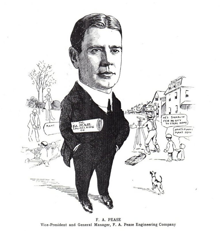
    <summary type="html"><![CDATA[<p><strong><em>When Fred Alwood Pease, the founder of F. A. Pease Engineering Company, died in 1955, his obituary noted that his engineering firm had designed the roads and streets of approximately 30 square miles of Cleveland's eastern suburbs. Among those suburbs were Shaker Heights, Cleveland Heights and Gates Mills.  As almost all of the present day streets of Shaker Heights were designed by this engineering firm, it would be somewhat arbitrary to select any street as the marker for this story. So instead we've selected Shaker Lakes Park as the site for this story, because the parklands were the one constant in their engineering work which the firm could not change and around which the firm was compelled to exercise both its creativity and its engineering knowledge in designing for the Van Sweringens the first boulevards and avenues of Shaker Heights.    </em></strong></p><img src="https://temp.clevelandhistorical.clevelandhistorical.reclaim.hosting/files/fullsize/965a23c73b03d57294e22df291757181.jpg" alt="Engineering the Shaker Streets" /><br/><p>F. A. Pease was born in 1873 in Kingsville, Ohio, a small town in Ashtabula County. After graduating as valedictorian of his high school class, he came to Cleveland in 1891 looking for work.  He was employed in a number of private firms before landing a job as deputy county engineer for Cuyahoga County shortly before the turn of the century. In 1903, F. A. left his county job to found the F. A. Pease Engineering Company. The firm's design work for Fairmount Boulevard and other east side suburban streets soon caught the attention of a group of land investors that included O. P. Van Sweringen. The investors hired the firm in 1904 to begin laying out streets for the residential subdivisions which the group envisioned for the 1,300 acres of land former owned by the Shaker Colony. This land would within a decade become the original territory of a new garden suburb of Cleveland called Shaker Heights.</p><p>The streets of Shaker Heights as designed by F. A. Pease Engineering fit the model of early twentieth-century design for upper middle-class American suburbs. Rather than laying down a traditional square or rectangular grid of streets, the firm designed curvilinear streets for Shaker Heights which followed the natural topography of the land and attempted to retain as much of the natural beauty of the land as possible, including wooded areas and streams.</p><p>Harry C. Gallimore (1886-1958), who was hired by the F. A. Pease Engineering Company in 1908, and who later became a partner of F. A. Pease, was an especially important member of the street design team for Shaker Heights.  In addition to his skills as an engineer, Gallimore, who was an avid reader of English literature, drew upon that knowledge to name many of the streets of Shaker Heights. </p><p>Another prominent member of the firm was William E. Pease (1875-1943), a younger brother of F. A.  Arriving in Cleveland later than his older brother, William was formally trained as an engineer at the Case School of Applied Sciences.  After working for several years for his brother's firm, he was hired by the Van Sweringen Brothers to be the principal engineer for the rapid transit line and the Terminal Tower and Train Station.  In presenting his arguments to Cleveland City officials why the new train station in Cleveland should be located on Public Square rather than the Mall, Pease may have claimed, according to one newspaper account, that he was a descendant of Captain Seth Pease (1764-1819), the surveyor of Moses Cleveland who laid out Cleveland Public Square. While William Pease may have been distantly related to Seth Pease, research of his family history suggests that he was not a direct descendant.</p><p>The F. A. Pease Engineering Company brilliantly designed the streets and boulevards of Shaker. Their work significantly contributed to making Shaker Heights one of America's premier twentieth-century garden suburbs.  </p><p><em><strong><a href="https://temp.clevelandhistorical.clevelandhistorical.reclaim.hosting/items/show/409">For more (including 6 images) view the original article</a></strong></em></p>]]></summary>
    <published>2012-02-12T19:39:39+00:00</published>
    <updated>2026-04-17T19:17:38+00:00</updated>
    <link rel="alternate" type="text/html" href="https://temp.clevelandhistorical.clevelandhistorical.reclaim.hosting/items/show/409"/>
    <id>https://temp.clevelandhistorical.clevelandhistorical.reclaim.hosting/items/show/409</id>
    <author>
      <name>Jim Dubelko</name>
    </author>
  </entry>
  <entry>
    <title type="html"><![CDATA[Herbert C. Van Sweringen Home]]></title>
    <summary type="html"><![CDATA[<img src="https://temp.clevelandhistorical.clevelandhistorical.reclaim.hosting/files/fullsize/7b6476aa241d7ac9a47f15a443b1b079.jpg" alt="Herbert Van Sweringen&#039;s Home, ca. 1923" /><br/><p>Constructed in 1913, the Georgian Revival residence at 2931 Sedgewick Road was built as the home of the often-forgotten Van Sweringen brother, Herbert.  Born in 1869, Herbert was the eldest son of James and Jennie Sweringen.  James, an oil field engineer from Pennsylvania, was unable to perform strenuous labor due to an injury received during the Civil War, and often changed jobs. The Sweringen family moved to northern Ohio shortly after Herbert's birth, and eventually settled in East Cleveland following the death of Jennie in 1886.  As James became increasingly troubled with alcoholism, the responsibility of financially providing for the family fell on Herbert.  He worked at the Cleveland Storage Company, while his sisters Edith and Carrie Van Sweringen tended to his two younger brothers.</p><p>Throughout much of their lives, the careers of Herbert and his younger brothers, Oris and Mantis, were intertwined.  When employed as a bookkeeper at the Bradley Fertilizer Company around 1897, Herbert persuaded his younger brothers to take work at the firm.  O.P. and Herbert would leave the company to open their own business, the Pioneer Stone Company.  With the early efforts of O.P. and M.J. in developing land in the Shaker Heights area, Herbert was invited to take part in the business. He worked with his brothers in purchasing land and building smaller homes in Shaker, but was eventually relegated to supervising routine office functions.  In what appears to have been a rather unhappy and sporadic working relationship with his brothers, Herbert was regularly passed over for better positions.  He eventually parted ways with his famous siblings. Working as a director for various real estate businesses in Cleveland, Herbert would never become publicly associated with the real estate or railroad empires of O.P. and M.J.</p><p>Unlike his brothers and sisters, Herbert married and had a family.  He helped found Plymouth Church, and was a member of its board of trustees. Despite his own modest successes in the real estate business, Herbert could never match the achievements of his brothers. In 1924, the unknown Van Sweringen left his family in Cleveland to capitalize on Florida's booming real estate market and finally make a name for himself.  With money purportedly received from his brothers, Herbert joined forces with Miami realtor J.H. Meyer and purchased 500 acres of land.  The partners formed the Sun City Holding Company. Their plan was to create a new Hollywood in Florida.  Taking cues from the successful development in Shaker Heights, Van Sweringen and Meyer set aside land for a church, school, entertainment, and government offices. Streets were laid out and named for famous film stars, directors, and studios. The centerpiece of the city was a movie studio constructed by the holding company for the price of $300,000.</p><p>In October of 1925, the movie studio was dedicated.  Initially, the entrepreneurs achieved measurable success.  Spurred by the land boom in Florida, over $2 million of land sales were earned. The emerging cosmopolitan city soon had a handful of residences as well as a school, hotel, theater, church, city hall, and power plant. Two short movies were filmed in the state-of-the-art studio.  Just as quickly as the town emerged, the real estate speculation bubble burst in 1926. Land prices rose and the market was flooded with property.  Compounding the situation, a hurricane hit South Florida.  Seasonal visitors and tourism all but disappeared due to high price of land and the general wreckage brought on by the storm.  Sales dried up, and Sun City Holding Co. fell into debt and was dissolved.  Herbert filed for bankruptcy and returned to his family in Cleveland.  O.P. and M.J. helped pay for the losses, set up a trust fund for their brother, and persuaded him to retire from business.  </p><p>Suffering a stroke in 1938, Herbert Van Sweringen eventually left Cleveland in order to live with his son in Buffalo, N.Y.  He died on January 5, 1942.   The home of the eldest Van Sweringen brother was designated a Shaker Heights Landmark on September 26, 1988.</p><p><em><strong><a href="https://temp.clevelandhistorical.clevelandhistorical.reclaim.hosting/items/show/407">For more (including 5 images) view the original article</a></strong></em></p>]]></summary>
    <published>2012-02-06T00:01:47+00:00</published>
    <updated>2026-04-17T19:17:38+00:00</updated>
    <link rel="alternate" type="text/html" href="https://temp.clevelandhistorical.clevelandhistorical.reclaim.hosting/items/show/407"/>
    <id>https://temp.clevelandhistorical.clevelandhistorical.reclaim.hosting/items/show/407</id>
    <author>
      <name>Richard Raponi</name>
    </author>
  </entry>
  <entry>
    <title type="html"><![CDATA[Van Sweringen Demonstration Homes: Establishing the Shaker Village Standard]]></title>
    <summary type="html"><![CDATA[<img src="https://temp.clevelandhistorical.clevelandhistorical.reclaim.hosting/files/fullsize/2e9e8354d30ef2498c8758c1a5845e7e.jpg" alt="Peaceful Shaker Village" /><br/><p>The 1920s witnessed a time of explosive growth and expansion in Shaker Heights. With the opening of the rapid transit system between Cleveland and the suburb at the beginning of the decade, the population grew from less than 2,000 to over 15,000 by 1929. As the transit system expanded, leading further into the planned community, the Van Sweringen Co. promoted the sale of the newly accessible lands in part through the construction of <a href="https://clevelandhistorical.org/items/browse?tags=demonstration+homes">demonstration homes</a>. Employing renowned local architects to create designs and oversee development, the Van Sweringen Co. constructed a series of homes in areas that were to be opened for public sale. These homes not only acted as examples of the desired character and quality of structures required by the Vans, but offered those interested in purchasing land an image of the exclusive community's possibilities. </p><p>Both small and large groupings of demonstration homes were constructed on Parkland Drive, Moreland Boulevard (now Van Aken), Courtland Boulevard, and South Woodland in the early 1920s. Reflecting the guidelines presented to prospective clients by the Van Sweringen Co. in "Shaker Village Standards", the structures were to define the character of the residential neighborhoods and promote the sale of surrounding lots. As prescribed by the Van Sweringens for all Shaker residences, the demonstration homes were designed by prominent architects such as Phillip Small, Howell & Thomas, and Bloodgood Tuttle. </p><p>The architects' designs for these demonstration homes spoke to the qualities and character of residential construction desired by the Vans. Each home was architecturally distinct, but also built in harmony with both surrounding structures and the natural environment. Designs for the demonstration homes employed the three recommended architectural styles for Shaker residences: English, French, and Colonial. The sturdy yet picturesque homes offered visions of permanence within the highly landscaped rural setting. These demonstration homes were a symbol of the dignified, enduring community that the Van Sweringen Co. desired to create and market. Such homes provided the foundation from which the cosmopolitan residential neighborhood grew.</p><p><em><strong><a href="https://temp.clevelandhistorical.clevelandhistorical.reclaim.hosting/items/show/406">For more (including 12 images) view the original article</a></strong></em></p>]]></summary>
    <published>2012-02-05T22:45:57+00:00</published>
    <updated>2026-04-17T19:17:38+00:00</updated>
    <link rel="alternate" type="text/html" href="https://temp.clevelandhistorical.clevelandhistorical.reclaim.hosting/items/show/406"/>
    <id>https://temp.clevelandhistorical.clevelandhistorical.reclaim.hosting/items/show/406</id>
    <author>
      <name>Richard Raponi</name>
    </author>
  </entry>
  <entry>
    <title type="html"><![CDATA[Parkland Drive Demonstration Homes: Howell &amp; Thomas]]></title>
    <summary type="html"><![CDATA[<img src="https://temp.clevelandhistorical.clevelandhistorical.reclaim.hosting/files/fullsize/23593fb805f0f7293f635ee537c83637.jpg" alt="18414 Parkland Drive" /><br/><p>The design of at least 27 homes in Shaker Heights has been attributed to the architectural firm of Howell and Thomas, including the grouping of <a href="https://clevelandhistorical.org/items/browse?tags=demonstration+homes">demonstration homes</a> on Parkland Drive. Formed in 1908 by Carl Howell and J. William Thomas, the Columbus-based business made its name designing Revival style homes. The firm specialized in residential architecture for upper-class clients. The architects were brought to Cleveland by 1913 to help design homes for real estate developer Barton R. Deming's garden city suburb, the Euclid Golf Allotment. The firm relocated to Cleveland within five years and remained active in the construction of residences throughout Cleveland Heights. In 1922, the Van Sweringen Company retained the locally-renowned architectural firm to design four demonstration homes at Shaker and Courtland Boulevards. Their services were employed again in 1924 to design an additional seven demonstration homes at 3280 Maynard and 18414, 18428, 18500, 18524, 18560 and 18580 Parkland Drive.</p><p>The Parkland Drive demonstration homes not only advertised the possibilities of the emerging suburb, but provided examples to potential home owners of the type and quality of home appropriate for Shaker Heights. Designated a Shaker Heights Landmark on June 27, 1983, the homes are reflective of the Van Sweringen Company's architectural standards as well as Howell and Thomas' mastery of the Revival styles. The designs of the demonstration homes incorporated various French and American regional styles in a manner that captured distinctive elements without displaying a strict adherence to form. In this way, the homes were constructed to complement the surrounding built and natural environment. For example, due to the narrowness of the rear lot of the demonstration home at 3280 Maynard, the floor plan of the residence steps back - a design feature that allowed for multiple attractive window exposures and an interior space flooded with natural light. Similarly, gutters, downspouts and decorative gutter boxes were fashioned in copper in order that they weather to a natural green and blend with their surroundings. The Parkland grouping was estimated to have cost the Van Sweringen Co. over $250,000.</p><p><em><strong><a href="https://temp.clevelandhistorical.clevelandhistorical.reclaim.hosting/items/show/390">For more (including 10 images) view the original article</a></strong></em></p>]]></summary>
    <published>2012-01-11T16:34:13+00:00</published>
    <updated>2026-04-17T19:17:38+00:00</updated>
    <link rel="alternate" type="text/html" href="https://temp.clevelandhistorical.clevelandhistorical.reclaim.hosting/items/show/390"/>
    <id>https://temp.clevelandhistorical.clevelandhistorical.reclaim.hosting/items/show/390</id>
    <author>
      <name>Richard Raponi</name>
    </author>
  </entry>
  <entry>
    <title type="html"><![CDATA[Shaker Village Historic District]]></title>
    <summary type="html"><![CDATA[<img src="https://temp.clevelandhistorical.clevelandhistorical.reclaim.hosting/files/fullsize/7740803f41c224c7830e3660a6a23fa9.jpg" alt="Historic District, 1994" /><br/><p>Added to the U.S. National Register of Historic Places on May 31, 1984, the Shaker Village Historic District was created to recognize Shaker Heights' significance as a Garden City–influenced planned suburban community. The designation of Shaker Heights as a historic district helped to redefine the community's identity and reaffirm its intrinsic values.  Roughly bounded by Fairmount and Lomond Boulevards, Green, Warrensville Center, Becket, and Coventry Roads, nearly 80 percent of Shaker is currently located within the district.   While shaped to incorporate a handful of early Warrensville Township sites and structures, the historical significance of the area can be attributed to the Van Sweringen Co.'s success in creating a planned community that integrated architectural standards, landscaping, and public transportation. By developing an exclusive, highly regulated community, the real estate developers made good on their promise to those who invested in property - the enduring value of a home located within Shaker Village.   </p><p>Dramatic changes to both cultural norms and the physical landscape characterized postwar American society. These changes challenged the foundation from which Shaker Heights grew to prominence as an elite community.  Suburbanization and new routes of transportation redefined the role of both the suburb and the city.  The diverse population of Cleveland increasingly began to settle away from the city's core. This postwar suburban growth encroached upon Shaker Heights' borders. Shaker Heights remained prosperous throughout this process, but the class and racial segregation that defined its early years became untenable in the context of the social upheaval of the 1960s.  A shift in popular conceptions of class and race soon after visited the cosmopolitan community.  While integration was initially met with strong resistance, Shaker Heights eventually earned its reputation as a bastion of progressive and socially liberal thinking.  Within this new environment, the exclusivity that had both characterized Shaker Heights and helped reinforce its perceived value needed to be redefined.</p><p>The inclusion of Shaker Heights on the National Register reflected one strain of efforts to recreate a new community identity for the changing suburb.  Since the 1960s, citizen groups had designated various historic landmarks throughout the suburb to affirm and preserve a unique Shaker Heights identity.  Cemeteries, colonial homes, Shaker Square, and sites previously inhabited by the religious order of Shakers had become sites of public commemoration.  These displays were a reflection of a larger movement in American society to use preservation as a tool of beautification, promote the development of an American identity, and help create order within the new urban landscape.  An offshoot of Lyndon Johnson's Great Society programs, the National Register of Historic Places aimed to identify and protect historic sites in the United States. The designation of a district regularly enhanced property values, and was meant to foster a sense of community that encouraged the preservation of housing stock.  When sites such as Shaker Heights were designated historic districts, they received federal tax incentives that encouraged rehabilitation.  At the time of its inclusion on the National Register, nearly 5,000 well-preserved residences, churches, schools community buildings, and commercial structures built in the style of early 20th century colonial and revival architecture were located within the historic district.   The district was a means to redevelop a foundation from which the community could both reaffirm a sense of and physically maintain its exclusive character, thereby helping to ensure the value of the structures and their surrounds.  </p><p><em><strong><a href="https://temp.clevelandhistorical.clevelandhistorical.reclaim.hosting/items/show/384">For more (including 7 images) view the original article</a></strong></em></p>]]></summary>
    <published>2012-01-02T18:30:13+00:00</published>
    <updated>2026-04-17T19:17:38+00:00</updated>
    <link rel="alternate" type="text/html" href="https://temp.clevelandhistorical.clevelandhistorical.reclaim.hosting/items/show/384"/>
    <id>https://temp.clevelandhistorical.clevelandhistorical.reclaim.hosting/items/show/384</id>
    <author>
      <name>Richard Raponi</name>
    </author>
  </entry>
  <entry>
    <title type="html"><![CDATA[Kingsbury Building: A Self-Contained Commercial District Along the Shaker Rapid]]></title>
    <summary type="html"><![CDATA[<img src="https://temp.clevelandhistorical.clevelandhistorical.reclaim.hosting/files/fullsize/8b374a13c19160681653db43735b677e.jpg" alt="Kingsbury Building" /><br/><p>From its founding, Shaker Village was planned as a highly-regulated residential district. Promotional literature distributed by the Van Sweringen Co. offered prospective land buyers the security of a community that existed outside the influence of the urban environment. A strictly defined and governed landscape promised safety and order in a village that was both designed and advertised as a contrasting vision to the City of Cleveland. The Kingsbury Building, designated a Shaker Heights Landmark in February 1998, is an example of the small commercial zones that were integrated into this vision for the Van Sweringen's suburb. These centers of commerce were carefully designed to meet the needs of a growing population without undermining the residential character of the surrounding community.    </p><p>In an era coinciding with the emergence of formal zoning, urban centers were characterized by their mixed use.  Much of the urban core of Cleveland was a clutter of industry, homes, and commercial buildings. Those with the means to leave these polluted and congested spaces moved from the city center. Elite residential districts, most notably the row of mansions lining Euclid Avenue, found themselves susceptible to the continuing advances of the physical city. Little could be done to prevent Cleveland from swallowing these exclusive neighborhoods – homes were often converted into businesses or fell into disrepair. Within this context, the Van Sweringen Co. created a community that would stand the test of time through strict regulation. Standards imposed by the real estate developers were meant to ensure the financial soundness of land purchases in their utopian residential retreat.   </p><p>The Van Sweringen Co. first busied themselves with promoting the development of amenities that would act as the foundation for their elite community, including schools, public transportation, green space, churches and recreational facilities. Apartments, industry, bars and corner shops were initially excluded due to their association with urban life. By the 1920s, however, the need for commercial structures and more diverse housing stock became apparent. The costly rapid transit system built by the Van Sweringens not only provided new opportunities for people to relocate to Shaker, but also necessitated a larger population to sustain its existence. The Van Sweringen Co. quickly integrated the development of apartments and business districts into their planned community. Staying true to their vision of a residential suburb, these structures were strategically placed on the outskirts of the community along heavily used transportation routes.  </p><p>The Kingsbury Building was one of the early commercial structures and apartment buildings in Shaker Heights. The self-contained business district was conceived and designed using similar standards as those imposed by the Van Sweringen Co. upon residential construction.  Erected by the Leemore Company between 1926-1927 at what is now 3427-55 Lee Road, the prestigious architectural firm of Walker and Weeks was employed to design the multipurpose building.  Similarly to other commercial structures concurrently being constructed at Shaker Square, the Kingsbury Building was designed in the Tudor style. Prominently located at the intersection of Moreland Boulevard (now Van Aken) and Lee Road, the angled corner building presented a unified vision from the front with its recessed entrances and symmetrical design. Bounded by comparatively smaller residential lots on the southern edge of the city, the business district was placed near a Rapid station and away from more prestigious residential neighborhoods. The three-story edifice provided space for ten storefronts, eight offices and sixteen apartments. </p><p>During the early years of growth in Shaker, the Kingsbury Building was one of only a few locations where residents could purchase commercial goods and employ professional services. Early tenants included the Fisher Bros. Co., a jewelry shop, a beauty shop, a florist, the Village Drug Store, the Shaker Heights Electric Co., a fruit shop, a shoe repair shop, a dry cleaner, a delicatessen, and the Western Union office.  Offices were regularly occupied by dentists, physicians, and real estate agents.  </p><p>While the Kingsbury Building was an inevitable response to the needs of a growing population, its form, placement, and usage were dictated by the standards created by Shaker Height's developers.  In this manner, the Van Sweringen Co. promoted growth and provided conveniences to the residential community while maintaining their promise to keep the influences of the city at bay.</p><p><em><strong><a href="https://temp.clevelandhistorical.clevelandhistorical.reclaim.hosting/items/show/370">For more (including 8 images) view the original article</a></strong></em></p>]]></summary>
    <published>2011-12-19T23:34:52+00:00</published>
    <updated>2026-04-17T19:17:38+00:00</updated>
    <link rel="alternate" type="text/html" href="https://temp.clevelandhistorical.clevelandhistorical.reclaim.hosting/items/show/370"/>
    <id>https://temp.clevelandhistorical.clevelandhistorical.reclaim.hosting/items/show/370</id>
    <author>
      <name>Richard Raponi</name>
    </author>
  </entry>
  <entry>
    <title type="html"><![CDATA[Shaker Heights City Hall: William Van Aken and the Growth of a Suburb]]></title>
    <summary type="html"><![CDATA[<img src="https://temp.clevelandhistorical.clevelandhistorical.reclaim.hosting/files/fullsize/f99864fdf9d811781ce1ef49ac2ebba3.jpg" alt="Symmetrical Design" /><br/><p>William J. Van Aken (1884-1950) served as Mayor of Shaker Heights from 1915 until his death in 1950, overseeing its transition from rural farmland to one of the nation's wealthiest and most well-regarded suburbs. The opening of a new city hall in 1930 symbolized a turning point in this transition, as the city moved out of a modest structure on the site of the old Shaker religious community's meeting house at the northeast corner of Shaker Boulevard and Lee Road, and into a grand brick building featuring an imposing semi-circular portico framed by six two-story high Corinthian columns. The building at 3400 Lee Road--designated a Shaker Heights Landmark on July 26, 1993--was designed by Charles Schneider (who also designed Shaker Heights's Plymouth Church, Fernway School, Ludlow School, and Lomond School) in Georgian Revival style. The Village of Shaker Heights officially became a city the next year, capping twenty years of tremendous growth.</p><p>While the Van Sweringen brothers may be the best known figures in Shaker's history, the "third Van" also deserves credit for the city's rise.  William Van Aken grew up being friends with O.P. and M.J. Van Sweringen. All three worked as paperboys for the same Cleveland newspaper.  Van Aken worked the "country" route, beginning near his mother's farmhouse at East 125th Street and Larchmere Boulevard.  During the first decade of the 20th-century, both Van Aken and the Van Sweringens were working separately to develop farmland on Cleveland's east side.  Speaking to a reporter, Van Aken remembered this as "a rugged job, but I loved it. Carving a city out of wilderness is the most satisfying of experiences."  </p><p>Van Aken rekindled his friendship with the Van Sweringens during this time, using their help to win a seat on the Cleveland Heights Village Council. The three men then worked together to successfully have the old North Union Shaker lands (owned by the Van Sweringens) detached from Cleveland Heights, giving O.P. and M.J. firm control over their investment.  Indeed, the first three councilmen for Shaker Township (incorporated in July 1911 after approval by Cleveland Heights) were Van Aken, O.P. Van Sweringen, and the Van Sweringens' attorney.  The Van Sweringens could now feel confident that their vision of a highly-planned, "Garden City" suburb would take shape.</p><p>William Van Aken became mayor of Shaker in 1915 and soon after started his own real estate firm.  During his tenure as Mayor, he oversaw the construction of the Rapid Transit line to Downtown in the 1920s, and helped the city through the potentially catastrophic bankruptcy of the Van Sweringen Company in 1936, all while Shaker's population and land values continued to rise.  From 200 in 1911, Shaker grew to over 28,200 residents by 1950. Van Aken also created one of the nation's first municipal architectural review boards and stringently enforced the city's zoning regulations, actions which surely pleased the Van Sweringens, who viewed high design standards and careful planning as the best ways to maintain Shaker Heights's upper-class appeal, differentiating it from the crowded, smoky big city to its west.  </p><p>It was therefore quite fortuitous that the three former  paperboys renewed their friendship in adulthood: the Van Sweringens saw their investment blossom, Van Aken became an influential and respected community leader, and out of sparsely populated farmland grew a city that today continues to retain  its original charm and beauty.</p><p><em><strong><a href="https://temp.clevelandhistorical.clevelandhistorical.reclaim.hosting/items/show/362">For more (including 9 images&#32;&amp;&#32;1 audio file) view the original article</a></strong></em></p>]]></summary>
    <published>2011-12-13T16:02:02+00:00</published>
    <updated>2026-04-17T19:17:38+00:00</updated>
    <link rel="alternate" type="text/html" href="https://temp.clevelandhistorical.clevelandhistorical.reclaim.hosting/items/show/362"/>
    <id>https://temp.clevelandhistorical.clevelandhistorical.reclaim.hosting/items/show/362</id>
    <author>
      <name>Michael Rotman</name>
    </author>
  </entry>
  <entry>
    <title type="html"><![CDATA[First Baptist Church: A Reflection of the Van Sweringens’ Shaker Ideal]]></title>
    <summary type="html"><![CDATA[<img src="https://temp.clevelandhistorical.clevelandhistorical.reclaim.hosting/files/fullsize/4c072eba22f8eebc12ef6733c0c25e60.jpg" alt="Entrance to First Baptist Church" /><br/><p>Central to the success of the Van Sweringen brothers in the development of Shaker Heights was an understanding of the symbolic importance of both landscape and physical structures in defining a community.  A marketable, utopian society was devised and created through a strict adherence to form and function; the value of this physical world was reinforced by pre-existing standards and belief systems. The brothers understood the importance of creating the illusion of a cohesive, exclusive community in order to both give value to and promote the sale of residential real estate. This was, after all, the linchpin on which the success of their endeavor relied.  Schools, open spaces, recreational facilities, and churches were integral components to the image of an ideal society, and their construction was actively pursued and regulated by the Van Sweringen Co. These interlocking pieces of the brothers' planned community would shape the physical environment as well as the social, religious, and cultural norms of the community.  The construction of First Baptist Church of Greater Cleveland reflected the community and architectural standards imposed by the Van Sweringen brothers during an era of development and growth in the Village of Shaker Heights.</p><p>The First Baptist Church had a long and varied history prior to its present incarnation at the border of Shaker and Cleveland Heights.  Established in 1833 with 17 members, the congregation grew in numbers and prominence through the end of the 20th century.  Originally meeting at a rented school, the church eventually built and outgrew a building near Public Square (1835), a larger edifice on Euclid and East 9th (1855), and an imposing structure with a clock tower and 150-foot spire on East 46th and Prospect (1887) . Throughout its existence, the congregation had splintered off into numerous Baptist churches and missions in the Cleveland area.  While maintaining a rich history of mission work with immigrant communities and the poor, the church's early years were also defined by the forced separation of its black members into a mission that eventually became Shiloh Baptist Church.  </p><p>Stemming from a post-war economic boom, increased access to transportation, and a rapidly growing urban population, the 1920s witnessed a migration of residents away from Cleveland's core toward outlying middle and upper class communities.  As the First Baptist Church of Cleveland and its congregation slowly moved away from the increasingly crowded city, a merger with the Cleveland Heights Baptist Church was agreed upon in 1927. The Cleveland Heights Baptist Church had been established in 1919 and was therefore still a relatively new organization. Its 300 member congregation operated out of the Coventry Elementary School and were in the process of raising funds for a structure.  Following the agreement between the two congregations, the joint church was named the First Baptist Church of Greater Cleveland.  Such mergers were not uncommon with protestant congregations of the time, as it was believed that larger churches could work more effectively at a reduced cost.</p><p>Having agreed to spend no more than 10% of the $800,000 projected cost on land, a building committee from the church approached the Van Sweringen brothers concerning an eight acre lot near the border of Shaker Village and Cleveland Heights.  While the land was believed to be worth between $130,000 and $140,000, the brothers agreed to a price of $75,000 - to be paid in three installments of $25,000 plus interest.  This decision was not uncharacteristic of the brothers. Nestled between three residential boulevards, the land was visible and prominent. The Vans had regularly offered such grounds to institutions associated with the ideals of success, virtuosity, and community.  Similar agreements had been offered to other Anglo, protestant religious organizations and schools.  Terms of the agreement between the Van Sweringen Co. and First Baptist Church provided the former the right of design approval for outside features.  Such an agreement ensured that the structure would be built in harmony with the surrounding residential zone. </p><p>Also helping to cement the agreement between the real estate developers and First Baptist Church was the hiring of Walker & Weeks - Cleveland's most prominent and influential architectural firm.  Employing a team of architects, each with their own specialty in building types, Walker & Weeks had accumulated an incredible resume that consisted of banks, churches, residences, public buildings, and schools.  In Cleveland, they were best known for their work on Group Plan structures such as the Public Library and the Federal Reserve Bank.  The firm also had previously designed an extensive number of buildings in Shaker Village, including Van Sweringen Co. homes, Hathaway Brown School, and University School.  A key feature to many of their structures was the integration of classical styles with modern design elements.  The choice of materials and appearance of the buildings spoke to those with a classical education. In effect, the firm created symbols; a building's function and purpose was written into the landscape by calling upon historic architectural traditions.  While also known for working around the needs and financial constraints of clients, Walker & Weeks' reputation and success was founded upon their design of permanent structures that signified a great civilization - a direct contrast to much of the haphazard urban construction that characterized Cleveland's growth.  </p><p>Taking a little over a year to construct, First Baptist Church was dedicated in June 1929.  The final cost of structure at 3630 Fairmount Boulevard was reported to be $1,000,000.  Employing elements of Gothic design, the structure could immediately be identified as a traditional religious institution and called upon images of stoic European churches.  Features of the style, such as the use of Gothic geometry and consonance of proportion, conveyed meanings of order and harmony.  The traditional building was characteristically ornamented with numerous religious symbols and iconography to enhance the churchgoers' experience. In style and meaning, the impressive church complemented the nostalgic, romanticized environment developed by the Van Sweringens. Its 130-foot bell tower protruded upward from the manicured lawns and landscaped boulevards, affirming ideals of tradition, culture, and community.  Presumably pleased with the final design of the structure, the Van Sweringen Co. canceled the congregation's final payment of $25,000 as well as the interest due. The building, which acts as reminder to the community and architectural standards of the Van Sweringen Co., was designated a Shaker Heights Landmark on January 24, 1977.</p><p><em><strong><a href="https://temp.clevelandhistorical.clevelandhistorical.reclaim.hosting/items/show/347">For more (including 6 images) view the original article</a></strong></em></p>]]></summary>
    <published>2011-11-07T00:18:25+00:00</published>
    <updated>2026-04-17T19:17:38+00:00</updated>
    <link rel="alternate" type="text/html" href="https://temp.clevelandhistorical.clevelandhistorical.reclaim.hosting/items/show/347"/>
    <id>https://temp.clevelandhistorical.clevelandhistorical.reclaim.hosting/items/show/347</id>
    <author>
      <name>Richard Raponi</name>
    </author>
  </entry>
  <entry>
    <title type="html"><![CDATA[The Van Sweringen Brothers: Cleveland&#039;s Visionary Developers]]></title>
    <summary type="html"><![CDATA[<img src="https://temp.clevelandhistorical.clevelandhistorical.reclaim.hosting/files/fullsize/0bc0fb99ae7d596b3c71cca9c19c7acd.jpg" alt="Van Sweringen Bros., 1928" /><br/><p>Oris and Mantis Van Sweringen, the brothers responsible for the construction of both the Union Terminal Complex and the Village of Shaker Heights, are two of the least remembered contributors to the development of Cleveland and its suburbs. The shy, reclusive Van Sweringens — absent even from the Terminal Tower's grand opening ceremonies in 1930 — worked their way up from modest beginnings to amass a multi-billion-dollar railroad and real estate empire by the 1920s. Their Union Terminal project helped to revitalize Downtown Cleveland's traditional center, Public Square, while their Shaker Heights development proved to be enormously attractive to wealthy city residents and remains a viable community to this day.</p><p>The development of Shaker Heights began around 1905 when "the Vans" began planning a picturesque community where both the design of the houses and the type of people allowed in would be strictly controlled. These restrictions were put in place in order to maintain Shaker's spatial and social distinctiveness from the increasingly polluted and overcrowded nature of big-city life in Cleveland.</p><p>The Terminal Tower complex grew out of the brothers' efforts to provide a system of rapid transit from Shaker to Downtown Cleveland for suburban commuters. Their original plan for a small terminal near Public Square morphed into the massive Cleveland Union Terminal project, which included a new central rail station for the city in addition to the 52-story Terminal Tower and three other office buildings. </p><p>The brothers died relatively young — and only a year apart from one another — in the mid 1930s.  Much of their fortune had dwindled away with the onset of the Great Depression and the unraveling of their complicated series of holding companies. Many younger Clevelanders are likely unfamiliar with the story of the Van Sweringens, and one would be hard pressed to find a building or street in the area bearing their name. Their success at avoiding the spotlight has endured, leaving their contributions to Cleveland's history largely obscured. </p><p><em><strong><a href="https://temp.clevelandhistorical.clevelandhistorical.reclaim.hosting/items/show/66">For more (including 6 images, 1 audio file,&#32;&amp;&#32;2 videos) view the original article</a></strong></em></p>]]></summary>
    <published>2010-09-22T14:38:06+00:00</published>
    <updated>2026-04-20T22:49:46+00:00</updated>
    <link rel="alternate" type="text/html" href="https://temp.clevelandhistorical.clevelandhistorical.reclaim.hosting/items/show/66"/>
    <id>https://temp.clevelandhistorical.clevelandhistorical.reclaim.hosting/items/show/66</id>
    <author>
      <name>CSU Center for Public History and Digital Humanities</name>
    </author>
  </entry>
  <entry>
    <title type="html"><![CDATA[Terminal Tower: Cleveland&#039;s Signature Skyscraper]]></title>
    <summary type="html"><![CDATA[<img src="https://temp.clevelandhistorical.clevelandhistorical.reclaim.hosting/files/fullsize/1dc25e5ec5be8090d9d137bf06dfe245.jpg" alt="West Approach to Cleveland Union Terminal" /><br/><p>Although today the first sign of downtown that a motorist is sure to spot from any direction is the Key Tower, prior to its completion in the early 1990s the first sight was the Terminal Tower. Despite its eclipse by a later, taller skyscraper, the 52-story, 708-foot-tall Terminal Tower was an instant icon and has arguably remained Cleveland’s most potent symbol. The Terminal Tower, at least as a plan, didn’t start as a tower at all, but instead as a railway station known as the Cleveland Union Terminal. In the early 20th century, as Cleveland grew as an industrial powerhouse, many Northeast Ohioans used railway lines to get to their destinations. Ohio had one of the most extensive interurban networks, with over 2,000 miles of track. However, it was not commuter railways but rather intercity passenger trains that led to the creation of the Terminal. Steam locomotives produced excessive amounts of pollutants when converging downtown, hampering Cleveland’s goal of becoming a modern, attractive city. In the interest of smoke abatement, the Union Terminal project would rely on switching trains to electric engines at outlying rail yards before passing through the city, including its central rail terminal.
The only problem was where to place this symbol of Cleveland’s progress. Inspired by Chicago’s Columbian Exposition of 1893, Cleveland Mayor Tom Johnson and the Group Plan Commission began planning a “civic center” that would run from Superior Avenue all the way to the lakefront. This civic center centered on the <a href="https://clevelandhistorical.org/items/show/312">Mall</a> and was Cleveland’s dominant expression of the City Beautiful. But the plan to make a new railway along the lakefront as the grand point of entry to the city came to a halt because of unexpected developments. Enter the <a href="https://clevelandhistorical.org/items/show/66">Van Sweringen brothers</a>, Mantis J. and Oris P., a duo of real estate and railroad tycoons who were keen on connecting their master-planned suburb of Shaker Heights to downtown via a new rapid transit rail line. </p><p>While the Van Sweringens originally planned the Shaker Heights line, their ambition expanded. The brothers realized that for the station for Public Square to succeed, they needed to include railways and facilities next to it. After heated debates that lasted a few years, the Terminal cornerstone was set on March 16, 1927, tilting downtown Cleveland’s center of gravity decidedly back to Public Square and ending the concept of a Mall anchored by an imposing rail station. The project was estimated at around $170 million and the Union Terminal had its grand opening in 1930. Travelers to Cleveland found many shops and services inside the Terminal’s concourses without having to step outside, including the elegant English Oak Room, Fred Harvey Company concessions, Higbee Bros. department store, and the preexisting adjacent <a href="https://clevelandhistorical.org/items/show/465">Hotel Cleveland</a>. The 42nd floor was used as an observation deck, allowing a bird's-eye view of the city. The Terminal’s concept of a multiuse “city within a city” anticipated New York’s Rockefeller Center. The Van Sweringen brothers, never comfortable in the spotlight, did not attend the 1930 dedication, instead spending the day at Roundwood Manor, their country estate in Hunting Valley. </p><p>The Terminal Tower itself was built toward the end of the skyscraper craze of the 1920s. When completed in 1930, it was the tallest tower in the world outside New York City. If the “Vans” wouldn’t toot their own horn, there were plenty of others ready to trumpet the Terminal’s superlative status. Walter Ross, president of the Nickel Plate Railroad, effused that the tower was “the symbol of the city’s progress and the prophecy of its future. … Cleveland may be sixth in the census list of cities, but so far as its Union Station is concerned, if that is any consolation, it may regard itself as on a parity with the leading city.” </p><p>However, the completion of taller buildings in other cities periodically whittled down this superlative: to tallest in North America outside New York after 1953 and tallest between New York and Chicago after 1964. When Key Bank Tower was completed in 1991, the Terminal Tower became the second tallest in Cleveland and second tallest between the Big Apple and the Windy City. Nevertheless, the Tower’s architecture is something to behold, with the upper portion closely resembling New York’s Municipal Building. Both were modeled on ancient Roman types called sepulchral monuments, a favorite classical nod associated with the Beaux-Arts architectural movement of the late 19th and early 20th centuries. Ironically, by the time Cleveland’s iconic tower was built, even the Beaux-Arts style was antiquated as more architects embraced the emerging Art Deco and other modernist modes. </p><p>The choice of an older style of architecture may have reflected a desire to make downtown Cleveland appear more well-established. After all, despite the steady rise of skyscrapers on the skyline since the 1890s, Cleveland’s skyline had fallen further behind a handful of the nation’s other largest cities by the late 1920s. Although it was hardly an original and audacious design apart from its towering height, over the next few decades, the Terminal Tower grew to be a defining status symbol for Cleveland. The self-contained “city within a city” of interconnected buildings—all linked to the same central transit station—made for daily interactions with those who worked there. In 1970, the president of Terminal Management, Homer Guren, mentioned how his employees became “sort of a Tower family.” </p><p>Perhaps unsurprisingly, the Terminal Tower became a symbolic place in many other ways as well. To support the Cleveland Indians, twelve baseballs were dropped from the roof to the ground below. Only two of the balls thrown by third baseman Ken Keltner were caught by catchers Hank Helf and Frankie Pytlak. The Indians’ special treatment didn’t stop there, as the team’s flag flew atop the Tower during home games. In 1980, after Mayor George Voinovich’s election amid Cleveland’s long, painful slide in the 1970s, the Terminal Tower was illuminated from base to crown at night to symbolize the city’s comeback. The building adorned the logo for Yellow Cab taxis for many years, frequently found its way into Harvey Pekar's comic books, and was featured in the background of many television shows and movies, most notably the 2012 hit <i>The Avengers</i>. </p><p>More recently, the Terminal Tower has taken on a modern aesthetic, not just for the look, but to show support for the community. Thanks to the addition of LED lights in 2014, the Tower is lit up every night in a range of different colors: for the Cleveland Cavaliers, wine and gold; for the annual Pride celebration, rainbow; and even colored images like the Leg Lamp from <i>A Christmas Story</i>, which was filmed in Cleveland. During the 2020 Covid-19 pandemic, the Tower staged a special light show to signal hope for the city. The ever-changing colors of these lights keep Clevelanders’ eyes focused on the skyline, helping reinforce the Terminal Tower as an enduring symbol of the city.</p><p><em><strong><a href="https://temp.clevelandhistorical.clevelandhistorical.reclaim.hosting/items/show/21">For more (including 18 images, 3 audio files,&#32;&amp;&#32;1 video) view the original article</a></strong></em></p>]]></summary>
    <published>2010-09-15T17:35:24+00:00</published>
    <updated>2026-04-17T19:17:36+00:00</updated>
    <link rel="alternate" type="text/html" href="https://temp.clevelandhistorical.clevelandhistorical.reclaim.hosting/items/show/21"/>
    <id>https://temp.clevelandhistorical.clevelandhistorical.reclaim.hosting/items/show/21</id>
    <author>
      <name>Katherine Gerchak&amp;#32;&amp;amp;&amp;#32;J. Mark Souther</name>
    </author>
  </entry>
</feed>